Indrahar Pass Trek
Indrahar Pass Trek, Mcleodganj Dharamshala
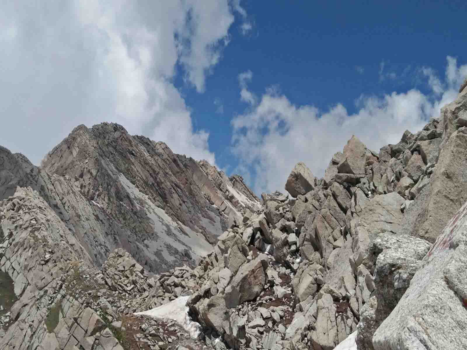
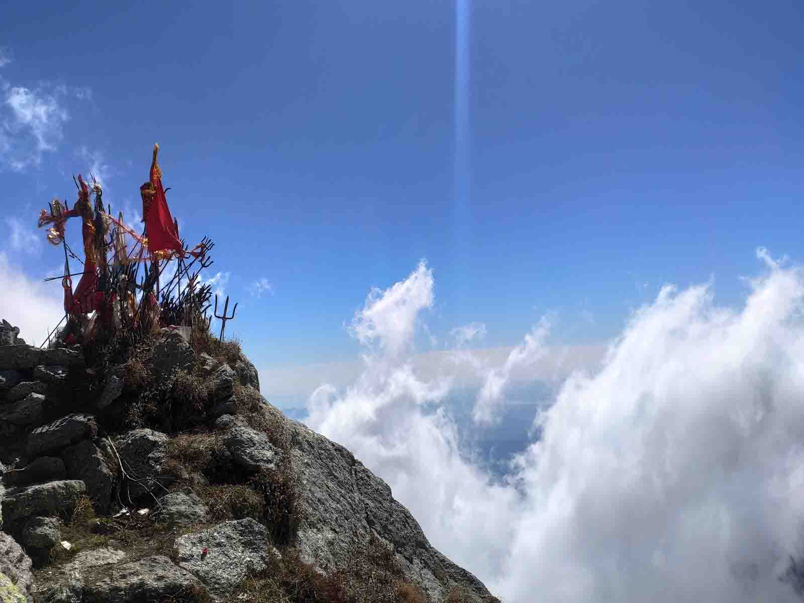
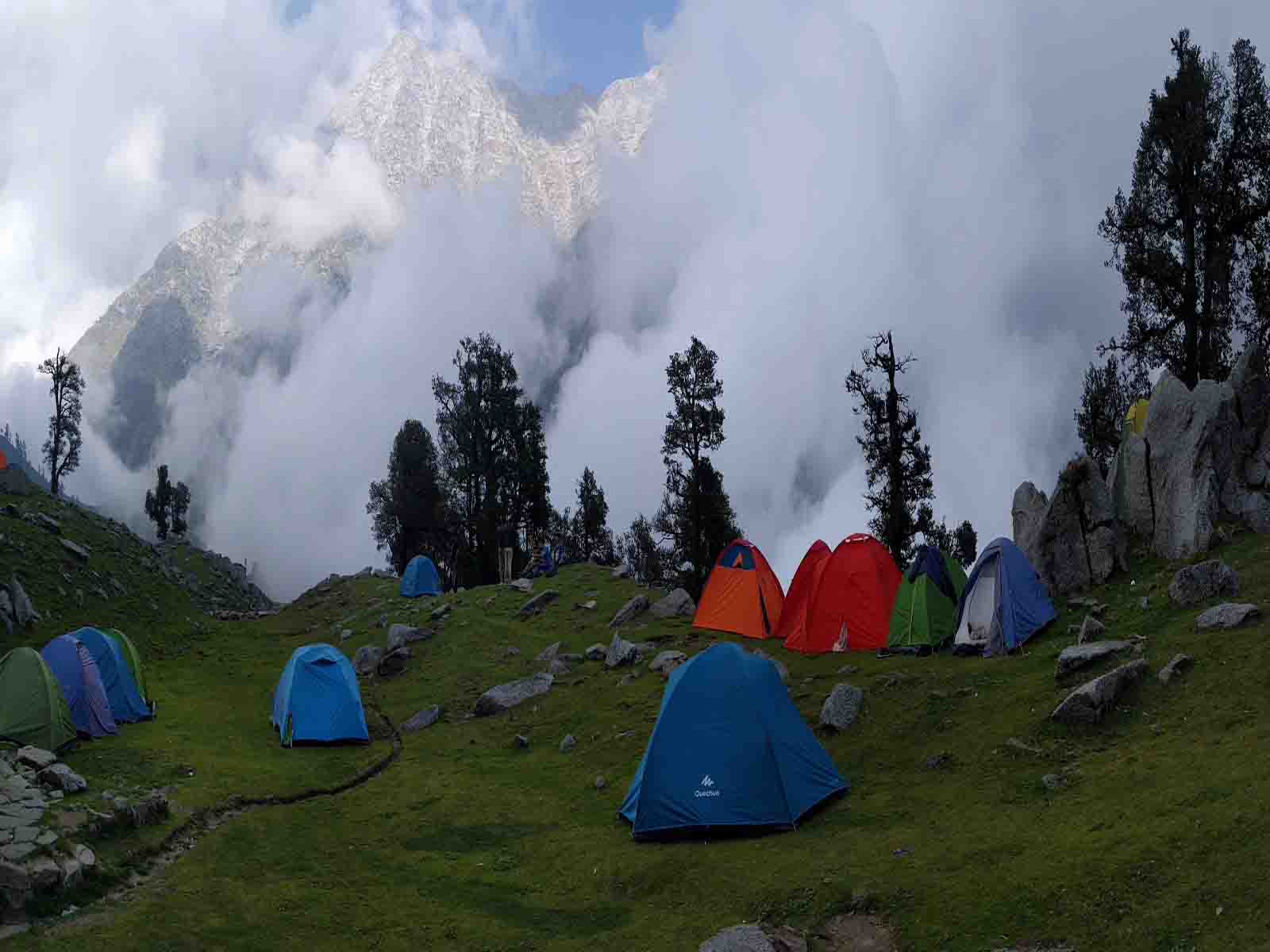
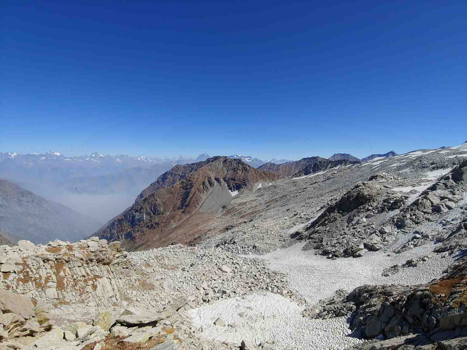
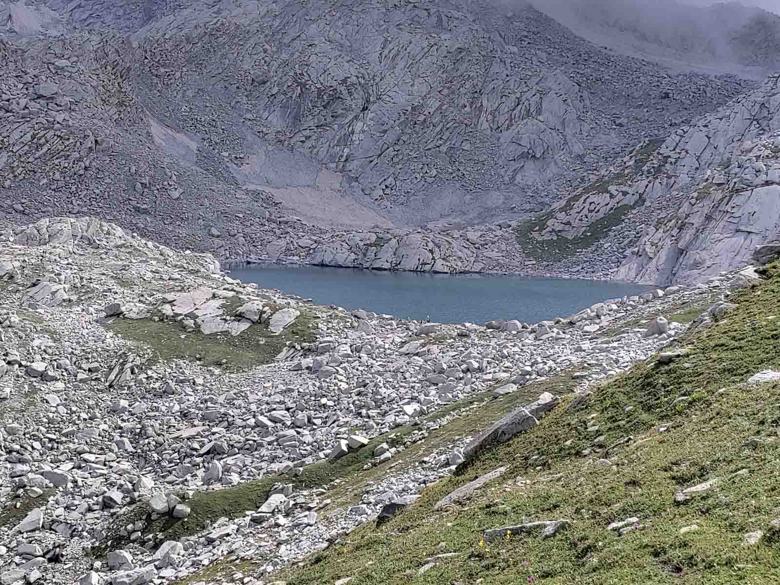
Indrahar Pass is a mountain pass in the Dhauladhar range of the Himalayas, near the tourist town of Dharamshala in Himachal Pradesh. It is located at an altitude of 4,342 metres (14,245 ft) above sea level and forms the border between Kangra and Chamba districts. It is part of a very popular trekking route from Dharamshala that passes through scenic landscapes, forests, meadows, and caves. The trek is challenging but rewarding, especially during the monsoon season when the range is lush green and full of flowers. However, the monsoon also brings many obstacles such as landslides, rockfalls, and swollen rivers, so trekkers need to be well-prepared and cautious. Indrahar Pass offers stunning views of the Pir Panjal range and the Manimahesh Kailash peak on the other side of the pass
Tour Program
Indrahar Pass Trek Itinerary
Overnight Guesthouse / Camping
Overnight Camping
Overnight Camping
END
Indrahar Pass Trek
Overview:
The Indrahar Pass Trek spans approximately 10 days and takes you across the rugged Dhauladhar mountains. These peaks serve as a geological model of the entire Great Himalayan Range.
The trek begins and ends in Mcleodganj, located on the outskirts of Dharamshala.
Along the way, you’ll encounter fabled destinations like Triund, Ilaga Pass, and the mystical Lahesh Caves.
Diverse Landscapes:
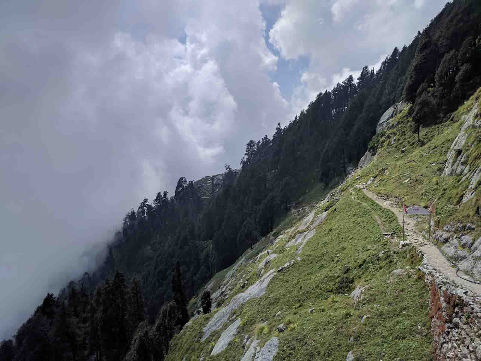
The trail offers a kaleidoscope of landscapes, from lush green valleys to rocky ridges. You’ll traverse through tropical highlands near the great Himalayan rivers and ascend to the sub-arctic wastes at the ridge’s pinnacle.
The Kangra and Chamba valleys flank the Dhauladhar range, standing like a protective wall between the Beas and Ravi rivers.
Monsoon Magic:
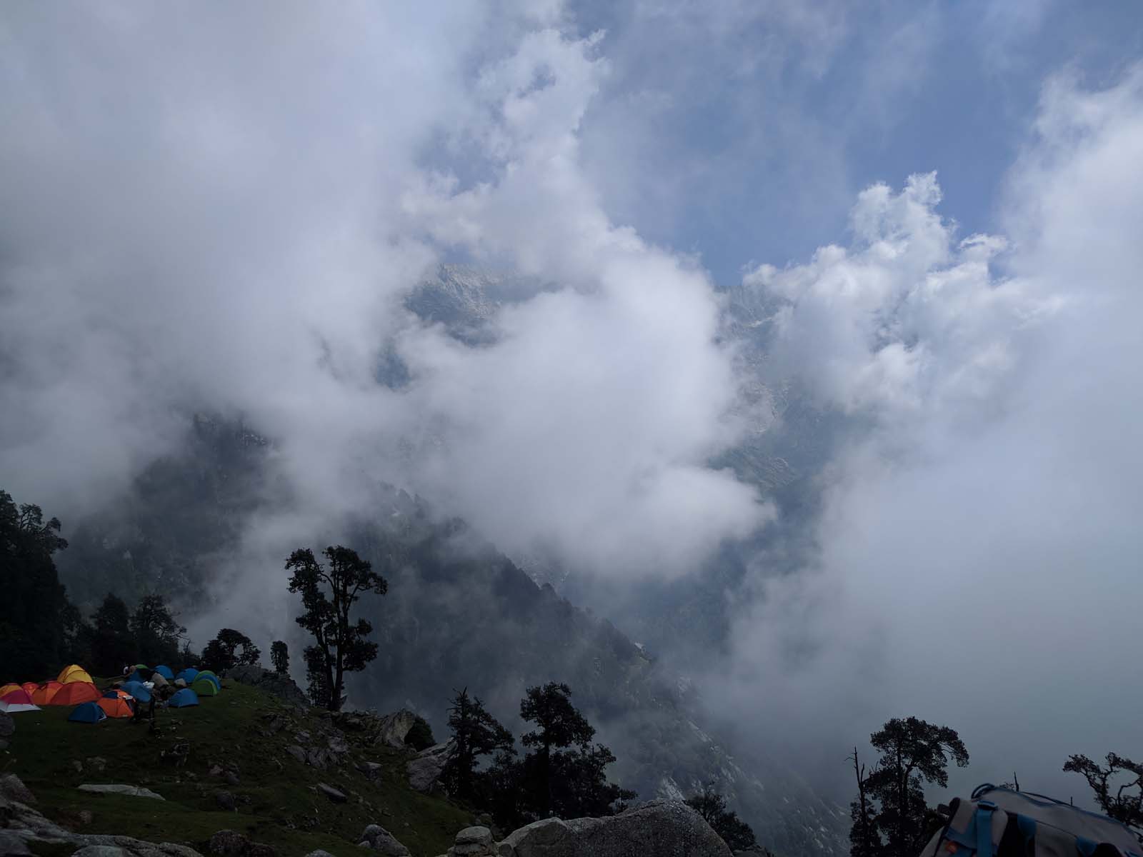
Our trek was during the monsoon season, an unusual choice for the Dhauladhar. The range experiences intense thunderstorms and heavy showers, especially in July and August.
Despite the formidable obstacles—falling rocks, wet trails, stinging nettles, and raging rivers—the monsoon offers solitude. You’ll have the entire range to yourself, except for Gaddi herders in their high camps.
Revel in the profusion of flowers and the sheer overload of greenery in all its hues.
Trail Highlights:
Galu Devi Temple above Dharamkot village marks the starting point.
Key camping grounds include Triund, Ilaqua/Laka Got, and the Lahesh Caves.v On the other side of the pass, explore Chhata Caves at 3,242 meters and Kuarsi Village in Chamba at 2,260 meters.
Distance:
Approximately 35 kilometers over 4 days.
Best Time:
May to October for pleasant weather and clear skies.
Interact with locals in small villages along the trail and immerse yourself in their culture.
Indrahar Pass Trek—where adventure meets geology, where rain-soaked trails lead to breathtaking vistas. Lace up, breathe in the mountain air, and let the Dhauladhar whisper its secrets.
For bookings and inquiries, contact +91 9736018883
indrahar pass trek best time to visit
Early Months (January to April):
During this period, there is high snowfall on the passes, which gradually melts by August.
As you ascend, the weather becomes warmer and sunnier, with daytime temperatures ranging from 12°C to 20°C.
Nights can be chilly, with temperatures dropping to -2°C to 6°C.
September and October:
Trekkers can experience pleasant weather with occasional snowfall.
Daytime temperatures vary from 12°C to 18°C.
Nights are colder, with temperatures ranging from -6°C to -4°C.
So, if you’re planning to embark on this adventure, consider visiting during late summer or early autumn to enjoy the best of the Indrahar Pass Trek. 🏔️❄️
The Indrahar Pass lies on a stretch of the Dhauladhar range, offering an alluring view of the hamlets below. It also acts as a border between Chamba and Kangra districts. The trek stretches from a height of 2,875 meters to 4,425 meters and is considered an easy to moderate level trek—an amazing place to start your trekking journey. The serene waters of Lake Mankiani and Kareri, along with the fascinating avifauna at different altitudes, add extra color to this journey. 🌿🏞️
There are many other treks in Himachal Pradesh that you can explore. Here are some of them:
This trek takes you to the beautiful Bhrigu Lake, which is said to change colors with the seasons. The trek offers panoramic views of the Pir Panjal, Dhauladhar, and Great Himalayan ranges. The trek is moderate in difficulty and can be done in 3 to 4 days. The best time to do this trek is from May to October.
Pin Parvati Pass Trek:
This trek is one of the most challenging and rewarding treks in Himachal Pradesh. It crosses the Pin Parvati Pass at an altitude of 5,319 meters, connecting the lush Parvati Valley with the barren Spiti Valley. The trek offers a diverse landscape of forests, meadows, glaciers, rivers, and villages. The trek is strenuous in difficulty and can be done in 10 to 12 days. The best time to do this trek is from July to September.
Triund Trek:
This trek is one of the most popular and easy treks in Himachal Pradesh. It takes you to the Triund Hill, which offers a stunning view of the Dhauladhar range and the Kangra Valley. The trek is suitable for beginners and can be done in 1 to 2 days. The best time to do this trek is from March to December.

How to Reach McLeodganj Dharamshala
By Air:
The nearest airport to McLeodganj is Gaggal Airport, located approximately 30 kilometers away. Taxis are readily available here for the onward journey.
For those flying from major cities, Chandigarh Airport is the closest major airport, well-connected to destinations across India. If you’re arriving internationally, Delhi Airport is your gateway.
By Road:
From New Delhi: McLeodganj is approximately 477 kilometers away, and the journey takes around 8 hours and 36 minutes by road.
From Chandigarh: The distance is about 248 kilometers, and the drive takes approximately 5 hours and 9 minutes.
From Gurgaon: Covering a distance of 514 kilometers, the road trip lasts around 9 hours and 25 minutes.
From Shimla: The drive spans 240 kilometers and takes approximately 6 hours and 29 minutes.
From Manali: The distance is 236 kilometers, and the journey lasts around 6 hours and 36 minutes.
From Mumbai: If you’re traveling from Mumbai, it’s a longer journey of 1,897 kilometers, taking about 1 day and 6 hours.
From Agra: The road trip covers 692 kilometers and takes around 11 hours and 33 minutes.
From Kolkata: For travelers from Kolkata, the distance is 1,946 kilometers, and the drive lasts approximately 1 day and 7 hours.
From Bangalore: The journey from Bangalore spans 2,613 kilometers, taking about 1 day and 15 hours.
From Jaipur: If you’re starting from Jaipur, it’s approximately 763 kilometers, with a travel time of around 12 hours and 26 minutes.
By Train:
The nearest railway station to McLeodganj is Kangra Mandir, located just 25 kilometers away.
For those arriving by broad gauge trains, Pathankot Railway Station is the closest major station, approximately 90 kilometers from McLeodganj. Taxis and buses are easily available from there.
Local Transport in McLeodganj:
Once you’re in McLeodganj, the best way to explore is on foot. You can also hop on rickshaws for relatively longer distances.
McLeodganj—where the mountains echo with ancient tales, and every step leads to nature’s secrets. Lace up your shoes, breathe in the crisp mountain air, and let the adventure unfold!
For bookings and inquiries, contact +91 9736018883